Dates
Address
Responsibles
Participants
Dell'Unto, Nicolò
Berggren, Åsa
Fauvelle, Mikael
Dininno, Domenica
Campanaro, Danilo
- 1. VV2023 Topography and heritage environment
- 2. VV2023 Aim of investigation
- 3. VV2023 Methodology
- 4. VV2023 Results. Investigations on the settlement site (2022)
- 5. VV2023 Investigations on the Hill site (trench A). Posthole and ditch
- 6. VV2023 Investigations on the Hill site (trench A). Layers 1050 and 1052
- 7. VV2023 Investigations on the Hill site (trench A). Layers 1065 and 1069
- 8. VV2023 Investigations on the Hill site (trench B). Posthole 1072
- 9.VV2023 Investigations on the Hill site (trench B). Floor layer 1060
- 10. VV2023 Investigations on the Hill site (trench B). Context 1071
- 11. VV2023 Investigations on the Hill site (trench B). Context 1068
- 12. VV2023 Investigations on the Hill site. Finds
- 13. VV2023 Investigations on the Hill site. Interpretation
- 14. VV2023. Metal detectors
- 15. VV2023. Discussion
Since 2012, an archaeological research project on Iron Age Blekinge is ongoing. Within this framework, Västra Vångs village in Hjortsberga parish has special focus. The settlement found in connection with the village has a settlement continuity from the Roman Iron Age to the Viking Age and has a high scientific potential in several ways. Over the years the work has mainly been carried out through Blekinge Museum's collaboration with Lund University and Södertörn University, but with significant help also from associations and individual volunteers. The project has in many ways increased knowledge of the importance of the village and expanded our understanding of the region during the Iron Age. An overall state of knowledge is reported in an English-language publication published in spring 2024 (Henriksson et al. 2024).
Fieldwork over the years has focused on obtaining new knowledge that contributes to a discussion of central places and more fundamental aspects relating to economic and social issues concerning both Iron Age Vång and Iron Age Blekinge more generally. Ritual remains have been repeatedly investigated, not least on the hill in the centre of the settlement. In parallel with this, investigations and documentation have also been carried out in the sub-areas of the settlement where dwellings and craft activities of various kinds have been identified.
The Vång project 2022-23 was carried out in accordance with the County Administrative Board's decision and paragraph 2. 8 § Kul- turmiljölagen (1988:950) (431-3886-2022). The investigation was funded by some contribution from Ronneby municipality and by self-financing of Blekinge Museum, Lund University and through the participation of volunteers from the ancient monument associations in Blekinge and Kronoberg. This report is a comprehensive account of the results of the archaeological research campaigns 2022-23.
The village of Västra Vångs is located in the Blekinge midlands, as the crow flies, about a mile north-east of the urban centre of Ronneby and less than a mile (Note: Swedish mile = 10 km) from the sea (fig.1). The pebble ridge called Johannishusåsen, which is clearly visible in places, gives the local N-S running valley its character. This is due to a combination of flat, undulating moraine heights and now drained wetlands. The higher terrain to the east and west of the valley is forested, while the valley itself is largely cultivated. The archaeological picture is dominated by graves from the Bronze and Iron Ages on marked elevations in the terrain. There are also a small number of registered settlements from the Neolithic period onwards in arable and meadow land. The historical village of Vång has not been affected by later land reforms, and is at least already in the 17th century divided into two locations, one east and the other west of the valley. Since the late 17th century, the village has been incorporated into the ownership of the Johan-nishus estate. Evidence of ancient remains within the village has been documented in particular in fields and meadows, on and around the high ground in the centre of the valley. The dated remains range chronologically from the pre-Roman Iron Age to the late Viking Age.
The overall aim of the 2022-2023 subproject was to clarify the state of knowledge and present an updated picture of the archaeological site. The aim of the project 2022-23 was to use field archaeological methods such as excavation, sampling and metal detecting to obtain further knowledge about Västra Vång, both up on the hill and in the arable land south of it, and to put this in relation to an already existing state of knowledge.
The specific purpose of the investigations on the hill in 2023 was to clarify the interpretative basis for the building remains, which had been the subject of investigation for several years (Svensson & Derudas 2024). In particular, the investigation focused on verifying previous results regarding postholes and floor layers, and if possible investigating the relationship between stonework and construction within the intended southeastern part of the building. As in 2021, the investigations on the hill were part of the DIAD (Digital Integration Across Disciplines) project at Lund University.
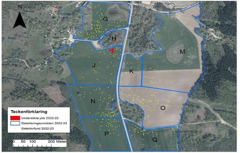
The project was a collaboration between linguistics and archaeology and meant that the investigations on the Vång hill were documented in sound and image in order to create a basis for a reflexive analysis of the fieldwork (Berggren et al. in prep).When investigating and detecting the arable land, the main focus was on clarifying the nature and extent of the settlement and craft areas south of the hill and in the direction of the Kasa Kulle grave field (Fig. 2).
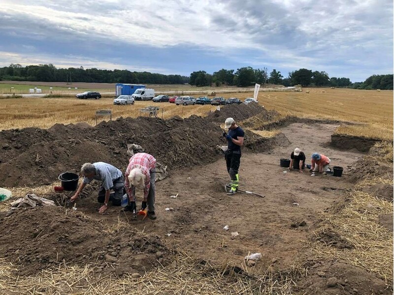
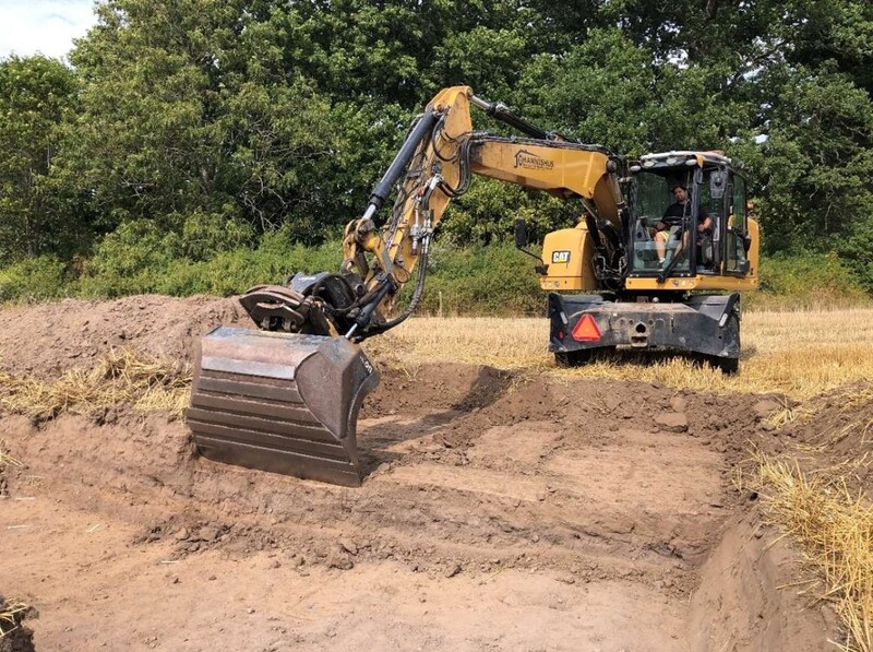
For logistical reasons, the investigations had to be divided into two field seasons. The investigation of the settlement (L1978:8879/RAÄ Hjortsberga 307) was extended to the period 18-29 August 2022. During this phase, a trench of just under 212 m2 was opened, with some overlap with the western part of the 2021 investigation area. Stripping was done in layers with an excavator, during which surface cleaning was done by hand. Finds encountered at the level of features and cultural layers were mainly surveyed with GPS or recorded manually on an analogue, scaled drawing, and finally screen-digitised against the digital property map in Sweref 99 (TM). Documentation was mainly carried out with a digital camera, but to some extent also through scaled hand drawing.
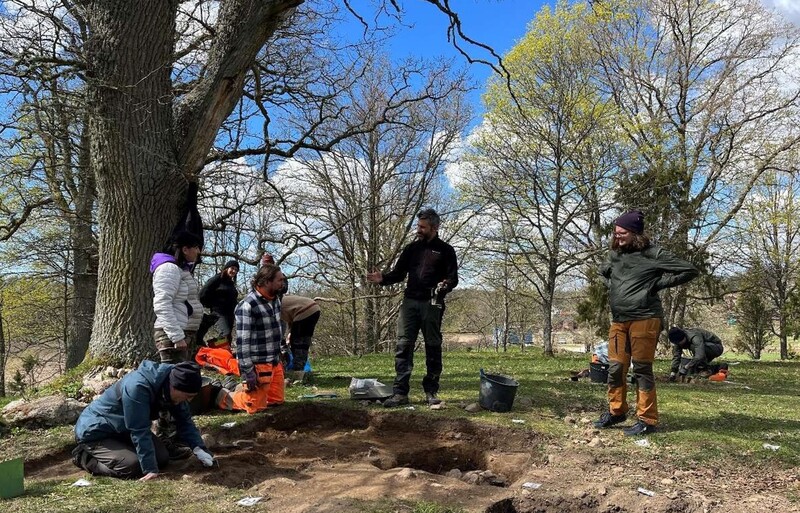
The second phase of the investigation was carried out on the hill (L1978:8860/RAÄ Hjortsberga 306) during the period 2-8 May 2023. Two trenches were opened (Trench A and Trench B (see appendix 3a and 3b). These partly overlapped with the trenches opened 2017-2021 (Trench A) and 2017 (Trench B). The previous trenches also had the same IDs in previous investigations (Henriksson 2018; 2020; 2021). Trench A measured 3 x 2 m in a north-south direction and Trench B just over 2 x 1.5 m in an irregular rectangular shape (see appendix 3b). In both trenches, the topsoil layer was removed by hand down to the cultural layer level where stratigraphic investigation took place. Documentation was carried out in its entirety by photogrammetric method (IBM) within the tool AIR (Archaeolo gical Interactive Reports), developed at Lund University (Derudas et al 2023).
In order to expand the interpretative basis for the complex stratigraphic situation on Vångkullen, all contexts that were interpreted to be related to the building or its preceding phases were sampled. In the northern part of Trench A, a smaller part was opened, which overlapped with the investigation trench from 2021. In this area, no features or layers were investigated, but the effort was focused on securing samples from the floor-layer sequence documented in 2021 (Henriksson 2022). Sampled material from the investigations in 2023 is intended to form the basis for future archaeobotanical and micromorphological analysis (see Appendix 3b).
As in several previous field seasons, metal detector excavation was carried out in 2022 and 2023 by free searching in predefined and previously evaluated sub-areas. This time, areas were also added around the Kasa Kulle grave field (Fig. 2).
Finds were collected in the larger trench to a large extent by hand picking in connection with topsoil stripping and in particular fine cleaning of the surface. In addition, finds were recovered during dry sieving of the stripped topsoil. The finds on the hill were recovered exclusively by hand picking in situ in connection with the ongoing 3D documentation. The finds from the detector surveys were continuously recorded on analogue field maps. These were rectified after the fieldwork, and then formed the basis for the creation of a GIS layer for the recovered finds, which formed the basis for a revision of the heritage site geometries in Fornsök.
Archaeological staff from Blekinge Museum and Lund University participated in the field. Metal detector surveys were carried out by three specially selected hobby detectorists with previous experience of work in Västra Vång. Volunteers from the archaeological societies of Kronoberg and Blekinge participated in the survey of the shaft in the field. Digital surveying was carried out by Andreas Svensson, Lund University and Niclas Olsson, Blekinge Surveyor. The conservation work was carried out by Max Jahrehorn, Oxider AB. The handling of finds done by Hanna Sjöberg and Siiri Irskog at Blekinge Museum and Sara Ahlgren, intern at the same institution.
The total area excavated in the field south of the hill was 212 m2. Weather conditions for the period were extremely dry, resulting in a less distinct cleaning than in the neighbouring 2021 survey area. More than 15 new features, mainly in the form of postholes and hearths, were documented on the surface (Appendices 1 and 2), which seemed to indicate post-built buildings and structures of some kind as well as activities at the site. The structures were only cleaned down to the level of the preserved cultural layer in the eastern part of the trench. However, none of them were investigated. Linear stretches of different coloured sand were noted during the excavation, which were immediately identified as possible remaining traces of the older road past Vångs by (appendix 1: A777 and A778).
Diagnostic excavation down to sterile sub-soil was done in the central part of the trench, with the aim of getting a representative picture of the character and thickness of the cultural layer. The cultural layer consists of a dark grey to black, silty and in places heavily soot-covered sand, and the soil characteristics is the same in this area as in most other places on the settlement. As in 2021, no cultural layer was preserved in the northernmost part of the trench, but the feature horizon emerged here directly under a 0.30 - 0.35 m thick topsoil layer. On the slope to the south the thickness increased, so that in the centre of the trench it was about 0.4 m thick. Further south the layer thinned to about 0.15 m. Towards the west the microtopography gradually went upwards, so that only patchy, thin strips of cultural layers could be observed west of the interpreted road bank A778.
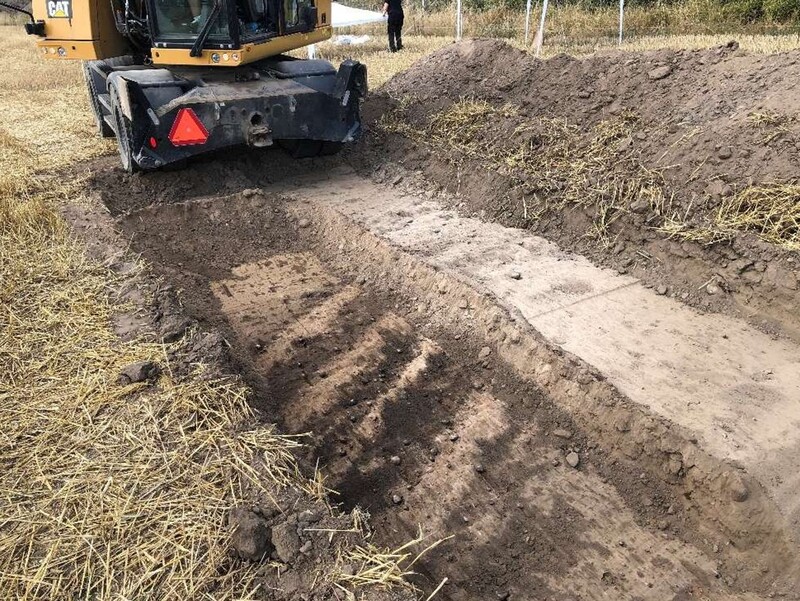
Features A777 and A778 appeared directly under the topsoil as a layer of light grey sand. Further cleaning, especially of A778, revealed that beneath the 0.20 m thick sand, parallel, 0.30-0.35 m wide strips of more humic sand appeared, mainly within a 5.0 m wide corridor in a NW-SE direction. On this claened level, single, iron nails (ron nails interpreted as being older than modern period) and heavily degraded iron fragments as well as a few pottery fragments were found. A narrow excavation was carried out by hand in A777 towards the northern edge of the trench (see picture on the front page of the report). This revealed that under a 0.35 m thick topsoil there was a level of light grey sand similar to that in A778. This was followed by a more compact layer of brownish grey silt, which at a depth of 0.7 m seemed to change into a dark brown silt with some small stones. This layer was up to 0.4 m thick and was followed by what was interpreted in the field as an undisturbed sterile subsoil. It should be emphasised that the narrow trench through A777 was dug by hand and under time pressure, so the results must be seen as partly hypothetical.
Interpretation
The interpreted direction of A777 and A778 is consistent with that of the older main country-side road, which is visible on older maps, but sometimes also as crop-marks and as lighter lines on aerial photographs. There is no doubt about this. The deeper part of the profile of A777 gave the impression of being a cultivated soil, which was emphasised by a prehistoric pottery find (Blm 29750:464). With the current state of knowledge it cannot be established whether this horizon represents an older sunken track, but it is a reasonable working hypothesis until a larger excavation by machine can be carried out at the site.
Finds
Finds were collected during the excavation by dry sieving or hand picking during fine cleaning of the strippe surface. Only 34 artefacts were surveyed to find point in the trench, and then exclusively in connection with the cultural layer in its northern part. These finds underlined the earlier interpretation of a sub-area within the settlement characterised by crafts and everyday activities. For example, a number of smithing hearth bottom (SHB), copper alloy melts were found, as well as several fragments of crucibles, loom weights and simple household pottery. The topsoil finds also corresponded with the finds that had previously been retrieved south of Vångkullen (Appendix 6).
Within trench A, a posthole (1064), a ditch (1065) and remains of floor layers and stone layers were investigated in the southern part, which constituted an area not previously stratigraphically investigated. Three layers of varying character and thickness were documented within the boundary of the posthole (contexts 1057, 1059, 1063).
The uppermost (context 1057) consisted of yellow-brown clayey silt. This layer was strongly reminiscent of the floor layer which completely or partially covered the feature. Below this was the main fill of the posthole (context 1059), which consisted of brown clayey silt and stone.
Beneath this layer a gravelier layer was observed (context 1063), which gradually changed into a layer with a greater element of gravel, but which was still judged to be a cultural layer. As it was not possible within the limited investigation to assess whether the layer constituted another layer in the posthole or an underlying context, the investigation of the feature at this level was stopped. In terms of shape and stone content, the feature is interpreted as a backfilled posthole. However, it should be clearly emphasised that the feature was located in the same area as two overlapping pits that were investigated in 2021 (see Appendix 3l).
These consisted of stone-filled pits, which at the time of the investigation were interpreted as deposition pits for deliberately dismantled bronze cauldrons (Henriksson 2022; Helgesson & Svensson 2024). The feature examined in the current investigation thus constitutes an additional pit-feature in this complex. Whether this group constitute overlapping deposition pits or postholes cannot be fully clarified at present, however.
The distance to the posthole located to the north may indicate that the presently investigated feature is the southern part of a pair of trestle posts. An equally likely alternative is that the complex can be interpreted as a collection of overlapping deposition pits placed between the pair of trestle posts in the building and that the southern posthole in the current pair of trestle posts can be sought further south. Based on the limited area of investigation so far, both options should be considered plausible.
With regard to layers, an upper (1050) and a lower (1052) layer were documented within trench A. The upper layer was clearly affected by root activity and infiltration from overlying topsoil. The lower layer was very similar in character to the floor layers documented in previous investigations (Henriksson 2022; Svensson & Derudas 2024) and is thus interpreted as a direct continuation of these. The floor layer partly covered posthole 1064 (see appendix 3c). Directly south of the floor layer was a stone-covered surface, which could be clearly distinguished from the extent of the floor layer (see appendix 3d).
Within this, part of a slightly curved ditch (1065) was documented and excavated, which was mostly filled with stone (see appendix 3e). Stratigraphically, it was not possible to determine whether the floor layer covered the ditch or whether the latter delimited the layer. The possibilities are therefore that the ditch is a drainage or construction ditch in the outer part of the structure or that it belongs to an older building phase. South of the trench a small remnant of a floor layer (1069) and a stony area were found, which was interpreted as part of a larger stone packing or a larger posthole, similar to the one investigated during the 2019-2021 investigation campaigns (see appendix 3j and 3k for interpretation suggestions).
Within trench B, a posthole (1072), multi-level floor layers (1053 (1058), 1061 (1062)), a stony layer interpreted as a levelling layer linked to the structure's foundation (1071) and an underlying layer of burnt material (1068) were investigated.
Similar to the situation in trench A, the upper stratigraphy consisted of a cultural layer affected by topsoil (1051 and 1055).
After this, a thin layer of silty clay which spread throughout the trench, which was interpreted as a possible upper floor layer. The layer covered posthole 1072 (see Appendix 3f).
We miss the record for context 1072, the cut!
Under the thin possible upper floor layer, remains of a lower, more substantial floor layer was documented. However, this was not preserved over the entire extent of the trench (see Appendix 3g). Similar to what was observed for trench A during previous investigations, the floor layers consisted of mottled yellow and dark brown sequences of sandy silt. Notable for the parts of floor layers investigated in trench B in 2023 is a dominance of darker parts, probably caused by a larger content of charcoal and burnt material. In the western part of the trench, at the same level as the floor layers, an irregular stone accumulation (1060) was documented.
This probably continues westwards beyond the limits of the trench and its extent and function could not be ascertained within the current investigation. Directly below the floor layer level a layer consisting of larger and smaller stones (1071) was investigated. This is interpreted to represent the foundation and ground levelling in the first phase of the construction (see Appendix 3h). It is possible that the stone accumulation 1060 should also be seen as part of this layer, but with an unclear stratigraphic position.
After the stone layer, a layer dominated burnt material (1068) was found. This is interpreted as the same layer as a similar layer documented in trench A between 2019-2021 (Henriksson 2022; Svensson & Derudas 2024). The stratigraphic situation for both previously investigated parts of trench A and the parts of trench B investigated in 2023 is similar, which is why this parallel is proposed. One difference between the two trenches is the stone layer seen within trench below the floor layer level. No equivalent to this has been observed in previous investigations in trench A.
The finds recovered from the investigation on the hill were relatively few in number. This can be attributed to the excavations focus on selected construction details and its spatial limitations. A number of fragments of copper alloy difficult to interpret, fragmented clay pottery and a single shard of beaker glass, a silver coin and a gold foil figurine were recovered from trench A.
The latter (Find nr 117) was found when cleaning topsoil in the southern area of the trench where a large posthole had been investigated in previous years.
The silver coin and the largest amount of other finds were retrieved from the upper topsoil-affected cultural layer 1050, while the underlying floor layer and ditch were remarkably empty of finds. However, a fragment of Cu alloy was retrieved from the ditch fill. A shard of beaker glass, some Cu-alloy fragments and burnt clay were retrieved from the posthole fill.
Trench B yielded mainly burnt bone and burnt clay, but also a whetstone, an iron object, slag and occasional pottery. The whetstone and slag fragment were recovered from the upper topsoil-affected cultural layer, which also contained fragments of burnt clay. Burnt bone and daub were recovered from the fill of the posthole and similar finds could also be attributed to the other investigated layers. The iron artefact was retrieved from one of the floor layer remains.
The few finds retrieved during the current investigation reflect well the type of finds previously retrieved from Vång Hill. Overall, the similarity in terms of finds, in line with other excavation results, suggests that all the contexts investigated belong to a coherent environment. However, this has a certain stratigraphic complexity and probably also a chronological depth beyond what can currently be proven.
The investigations on Vång Hill 2023 yielded a number of results regarding the interpreted structure dating to the Late and possibly also the Early Iron Age, which was documented on the highest crest of the hill during the previous years. For example, the presence of floor layers could be detected in both trench A and trench B.
This had a very similar character compared to the floor layers previously documented and it therefore seems likely that it should be interpreted as belonging together (see Appendix 3i). The posthole that was partially investigated in 2017 (Henriksson 2018) could also be confirmed and its similarity to the posthole that was fully investigated in 2021 (Henriksson 2022; Svensson & Derudas 2024) supports the interpretation of them both as constituting parts of the same structure, or buildings in different phases.
Recently, an interpretation of the building on Vång Hill has been presented (Svensson & Derudas 2024). This is largely a parallel to the Iron Age cult houses that have been found at central sites such as Uppåkra (Larsson & Lenntorp 2004) and Järrestad (Söderberg 2006). In the southernmost part of trench A, a stone formation is seen which hypothetically could constitute another conglomerate of postholes (see appendix 3j). If this can be interpreted as a posthole, this would support the previously presented interpretation. The presence of floor layers in large parts of the proposed extension also argues in favour of this. The hypothetically proposed building phase would measure just over ten metres in an east-west direction and up to six metres in a north-south width (see Appendix 3k). The trestle width of the proposed pairs of posts, which amounts to between two and three metres, given that each area consists of several overlapping postholes, seems somewhat large in relation to the Scanian parallels cited above. Nevertheless, several of the results from the 2023 investigations, taken together with the previous state of knowledge, indicate that the proposed interpretation may be plausible.
In this context, the posthole investigated in trench A during the current excavation is a complicating factor. In relation to the posthole investigated in 2019-2021, a trestle width of approximately 0.8 metres would be measured between the two. With such a trestle width for the construction, for example, greater similarities with the interpreted cult house in Järrestad would be seen (Söderberg 2006). If the posthole in question is to be interpreted on the basis of its similarity to the previously investigated one in trench A, however, the deposition pits investigated in 2021 should possibly also be reinterpreted as overlapping postholes. In such a case, the interpretation of the trestle width and distance would be considerably more difficult. On the other hand, it seems reasonable to interpret ditch 1065 in a delimiting function in relation to a narrower building phase based on both location and character (see Appendix 3l). A posthole parallel to that investigated within trench B at a distance of 0.8 metres has not been located in the current or previous investigations. In broader interpretation of the proposed building phase, a hypothetical parallel posthole would be located just over 1.5 metres from the area subject to stratigraphic investigation (see Appendix 3k). A parallel posthole in the narrower interpretation would be located considerably closer and would also be tangent to stratigraphically investigated trenches (see Appendix 3l). The 2013 investigations included the area where the two hypothetical parallel postholes are estimated to be located. However, the part of the then excavated area where the postholes could have been located was only subject to top soil stripping during these campaigns (Henriksson 2016). Based on the current state of knowledge, it therefore seems likely that both interpretations of building phases can be proposed on equally strong grounds. The most reasonable approach would seem to be that they are two chronologically distinct phases, which share certain elements of the structure, such as the northern bounding stone packings.
During metal detecting in the field in 2022-23, a total of 331 artefacts were recovered (Fig. 2). Of these, just over 10 were clearly datable to the Iron Age/medieval period. Previously registered areas within the settlement were given an even more clarification through the finds, and in several cases new find spots were added. This applies in particular to the immediate area around the Kasa hill grave field with fibulae, a fitting in the form of a small bronze mask and a fragmentary arm ring of silver, dating from the Migration to Viking periods (Appendices 6 and 7). In addition to this, further finds were found that suggest an even older presence in Vång in the form of fragments of a double button and a socketed axe from the Bronze Age.
In our opinion, the objective of the 2023 subproject has been met. Knowledge of the various sub-areas of the archaeological site has increased significantly with regard to Vång Hill, the arable land south of it, and also the presence of finds outside the core area of the settlement. On several points, there is now a broad knowledge base on which to base any decision on further investigations concerning, for example, the remains up on the hill.
The different interpretation options for the building on Vång Hill underline the importance of further chronological and stratigraphic analysis of the excavation results and the sample material collected from the current and previous surveys. A crucial prerequisite for further interpretation of the building phase(s) represented by the remains on Vång Hill is that the dating basis is expanded. This future work should focus on bringing chronological clarity to the construction elements investigated between the years 2019 and 2023.
These elements also include the documented floor levels. Therefore, during the current investigation, two samples for micromorphological analysis were secured in the area of Trench A, where the most coherent layer sequences were observed (see Appendix 3m). An interesting feature of the construction on the Vång hill is the significant element of stone packings and stone layers. These can be seen in the form of both the northern bounding stone packings, which were partly investigated in previous years, but also in the ditch and the foundational stone layer, which were investigated in the current investigation. The stone construction elements may indicate that further parallels to the building on the hill in Västra Vång may be possible in the future when their design and chronology have been further investigated in a more comprehensive excavation.
Today, the archaeological situation in Västra Vång is far more complicated than could have been predicted at the time of the first excavations at the settlement in 2004 (see Henriksson 2006 and 2024 and fig. 9). Not least the various metal detection surveys over the years the years have effectively contributed to expanding knowledge of the spatial extent, character and temporal depth of the archaeological site. This experience should, of course, be taken into account when discussions are held about possibly finding and delimiting further settlements along the Johannishus ridge, but also elsewhere in the county. The same applies to the exploratory investigations in various sub-areas in the arable land around Vång Hill. These have been cost-effective in terms of locating and delimiting traces of archaeological remains. The combination of extensive volunteer activities focusing on topsoil archaeology has further contributed to rich knowledge of the settlement as a whole. However, to fully understand the settlement's building and crafts areas requires not only a diagnostic archaeology that uncovers and recovers, but also one that investigates the settlement's remains to a much greater extent with far greater financial resources have been available so far.
Other Media


| Plane | Position | Flip |
|
|
||
|
|
||
|
|
| Show planes | Show edges |
0.0
[ 0 , 0 , 0 ]


