


-
Identifier
en
TARP2024_J_690_SU16008-11
3D model type
en
terrain
Title
en
TARP2024 Job 690 Stratigraphic Unit 16008-11
Item represented
Investigation campaign
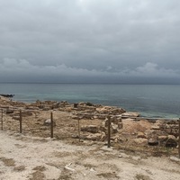
Investigation site

Dataset acquired by
Model format
en
nxz
Model measure unit
en
meter
Digitized by
Technique
en
IBM
Software
en
Agisoft Metashape
Dataset location
en
University of Cincinnati (US)
Date Created
June 10, 2025
Rights Holder
en
University of Cincinnati (US)
License
CC BY-NC
Images and medias are issued with permission of the Italian Ministry of Culture – Soprintendenza Archeologia, belle arti e paesaggio per la città metropolitana di Cagliari e le province di Oristano e Sud Sardegna. Models and images are available for consultation only, for scientific, teaching and research purposes, without profit. Any further reproduction or duplication by any means is prohibited.
Other Media
Linked resources
| TARP2024 Stratigraphic Unit 16008 |
| TARP2024 Stratigraphic Unit 16009 |
| TARP2024 Stratigraphic Unit 16010 |
| TARP2024 Stratigraphic Unit 16011 |
| TARP2024 Trench 16000 |


| Plane | Position | Flip |

 |
||

 |
||

 |
| Show planes | Show edges |
Measured length
0.0
0.0
Coordinates
[ 0 , 0 , 0 ]
[ 0 , 0 , 0 ]
Trackball position