Identifier
Title
Description
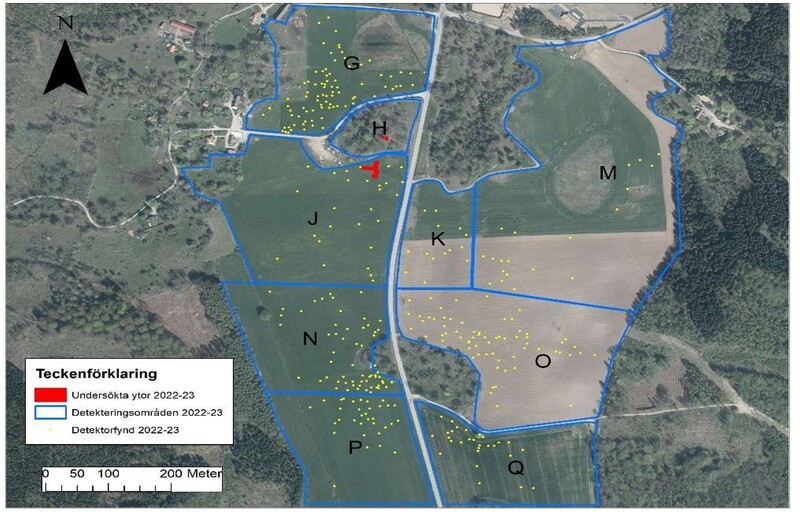
The village of Västra Vångs is located in the Blekinge midlands, as the crow flies, about a mile north-east of the urban centre of Ronneby and less than a mile (Note: Swedish mile = 10 km) from the sea (fig.1). The pebble ridge called Johannishusåsen, which is clearly visible in places, gives the local N-S running valley its character. This is due to a combination of flat, undulating moraine heights and now drained wetlands. The higher terrain to the east and west of the valley is forested, while the valley itself is largely cultivated. The archaeological picture is dominated by graves from the Bronze and Iron Ages on marked elevations in the terrain. There are also a small number of registered settlements from the Neolithic period onwards in arable and meadow land. The historical village of Vång has not been affected by later land reforms, and is at least already in the 17th century divided into two locations, one east and the other west of the valley. Since the late 17th century, the village has been incorporated into the ownership of the Johan-nishus estate. Evidence of ancient remains within the village has been documented in particular in fields and meadows, on and around the high ground in the centre of the valley. The dated remains range chronologically from the pre-Roman Iron Age to the late Viking Age.
Date Created
Rights Holder
License
Media (Images)
Linked resources
| VV2023 report 5 Trench A & B |


| Plane | Position | Flip |
| Show planes | Show edges |
0.0
[ 0 , 0 , 0 ]


