Identifier
GH2019_T_1_L4
Type
Title
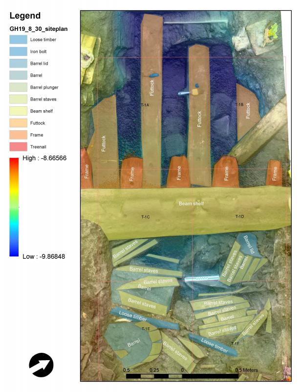
GH2019 trench 1 layer4
Description
The fourth layer of the rectangular 6 x 2-meter large trench excavated on the starboard side amidships with NW-SE orientation.


Investigation site
Investigation dates
August 30, 2019
Investigation technique
en
dredge
Model measure unit
en
meter
Longitude shift
513000
Latitude shift
6222000
Spatial reference system (EPSG)
en
EPSG:3006
Date Created
May 11, 2021
Rights Holder
en
Lund University (Sweden)
License
en
CC-BY 4.0


")